About Bonito, Brazil: Where It Is, Why the Water Is Clear and How Tourism Works
About Bonito, Brazil: Where It Is, Why the Water Is Clear and How Tourism Works
Bonito is a town of about 20,000 people on a limestone plateau in the southwest of Mato Grosso do Sul, Brazil. The rock is what explains the clear water.
Updated September 24, 2026 · Guia de Bonito editorial team
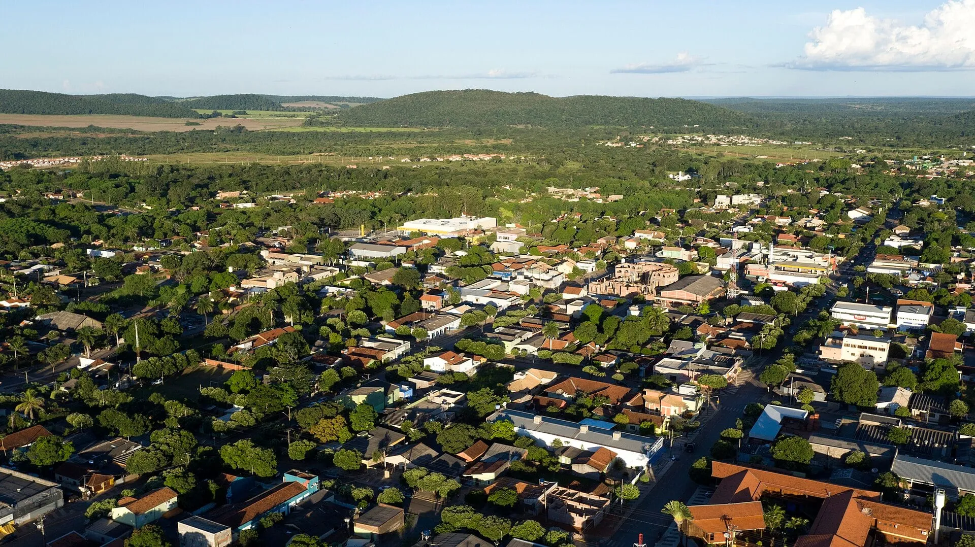
Bonito is a municipality of about 20,000 people in the southwest of Mato Grosso do Sul, a state in Brazil’s Center-West, about 300 km from Campo Grande, the state capital. What sets it apart from any other inland town in the state is the rock it sits on: a limestone plateau called the Serra da Bodoquena, responsible for the crystal-clear rivers, the caves and the waterfalls that sustain its tourism. This page introduces the town in broad strokes; its history, map and geology have their own pages, listed at the end.
Where it is
Bonito lies in the southwest of the state, between the Pantanal wetlands, to the north and west, and the border with Paraguay, farther south. Campo Grande is to the east, about 300 km by highway, roughly three to four hours by car. The neighboring municipalities that matter to visitors are Jardim, to the south, and Bodoquena, to the north, because some of the tours sold as “Bonito tours” are actually located there. The town has a regional airport with few flights; most people arrive via Campo Grande. See how to get to Bonito and the Bonito map.
The Serra da Bodoquena and the clear water
The Serra da Bodoquena is a plateau of very old limestone, cut by valleys where the region’s rivers run. Limestone is a rock that water dissolves slowly, and that explains almost everything a visitor sees:
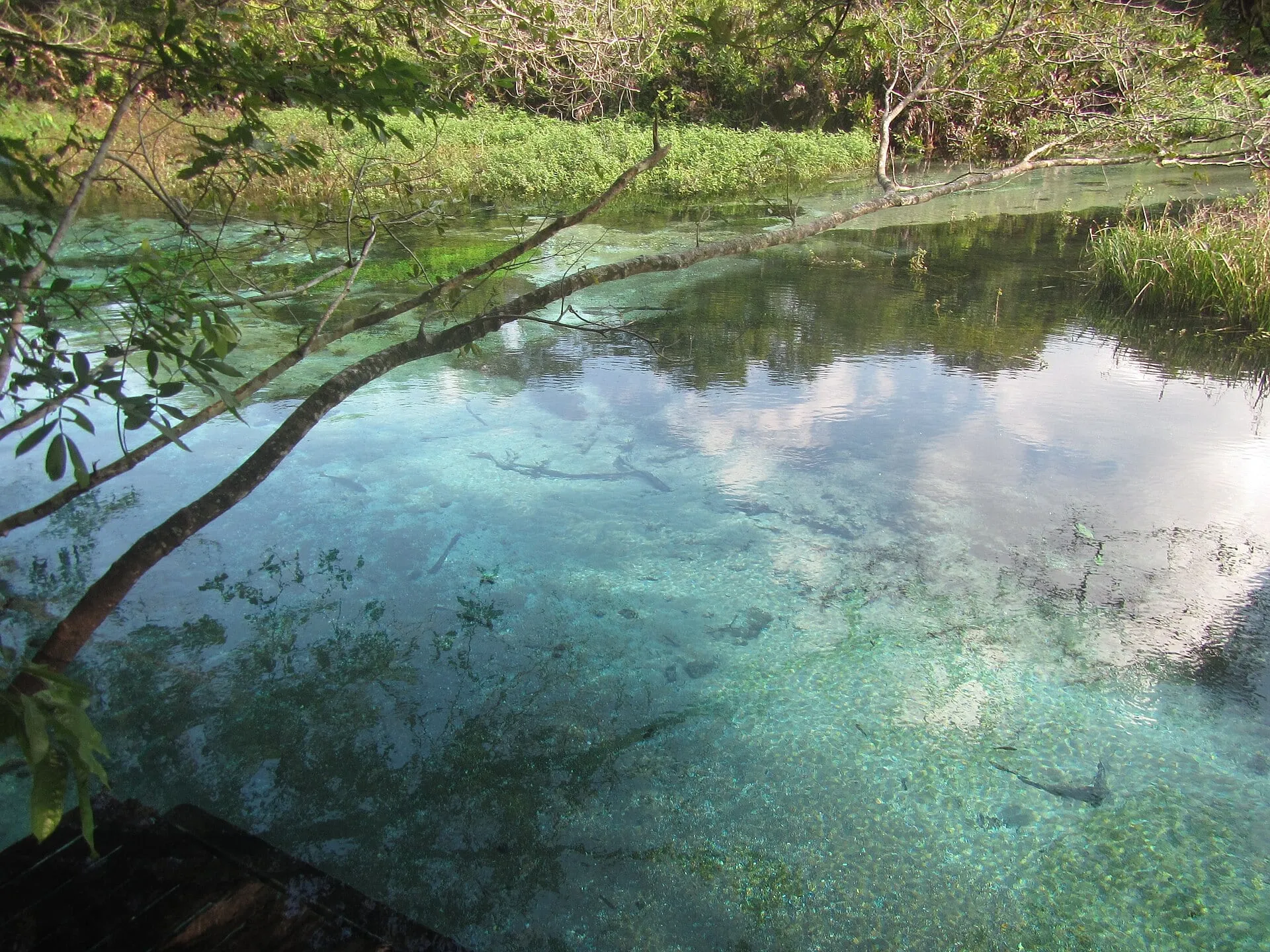
- Filtering. Rainwater seeps into the porous, fractured rock and travels underground before surfacing at the springs. It comes out clean, without the soil and mud that cloud rivers in other regions.
- Settling. Along the way, the water picks up calcium carbonate. This mineral makes suspended particles clump together and sink, and the riverbed ends up covered by a layer that holds the sediment in place. That is why visibility reaches tens of meters, and why touching the bottom is prohibited on snorkeling tours.
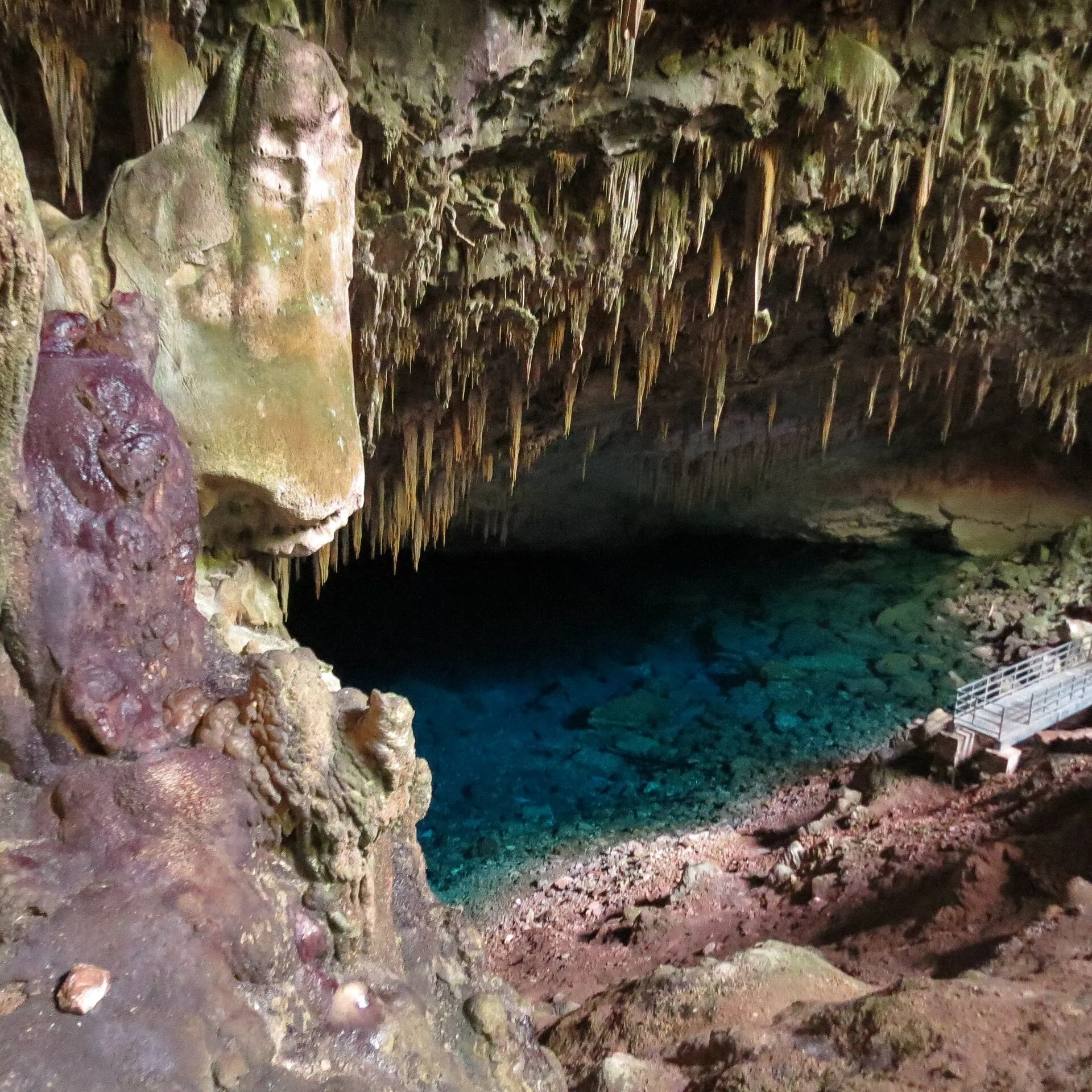
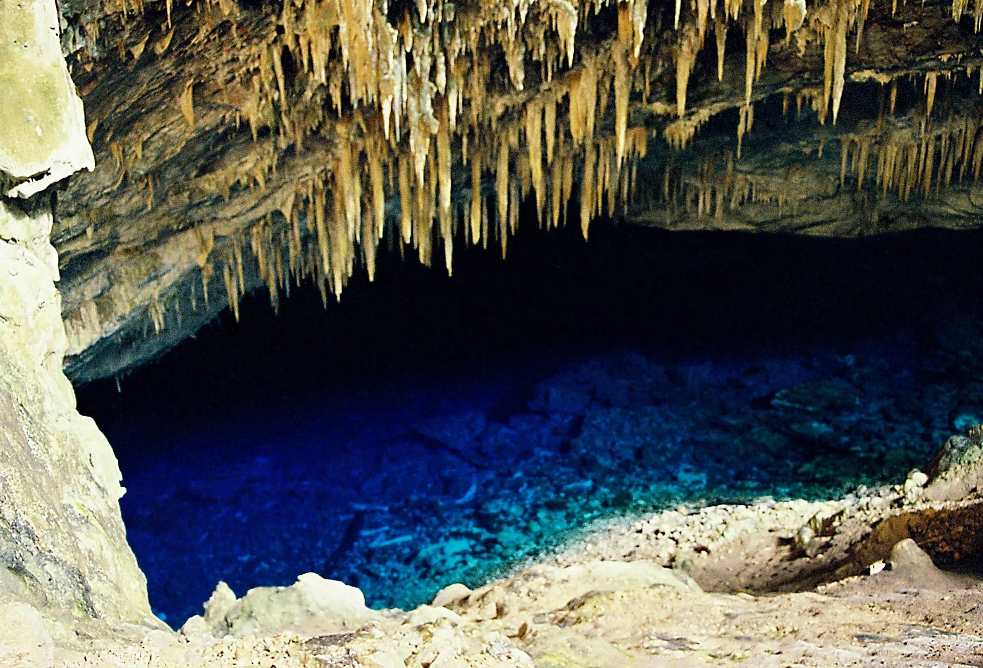
- Caves and sinkholes. The same dissolution opens galleries in the rock. When the roof of a gallery collapses, a sinkhole forms, like Buraco das Araras; when a gallery reaches the water table, an underground lake forms, like the one in the Blue Lake Cave.
- Waterfalls and natural dams. The carbonate is also deposited, forming barriers of calcareous tufa that create the stepped natural pools at the region’s waterfalls.
Heavy rain upsets this balance: runoff carries sediment from the banks and the river turns cloudy for hours or days. That is why river snorkeling tours are suspended or rescheduled after storms. The geology in more detail is in Serra da Bodoquena.
Population and the town
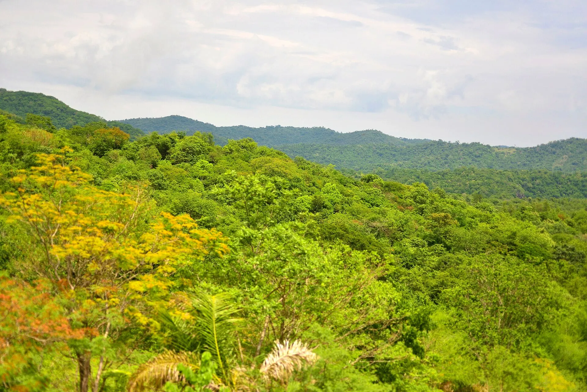
With about 20,000 residents, Bonito is small. The center is organized around Rua Coronel Pilad Rebuá, the main street, where the tour agencies, restaurants, ice-cream shops and stores are. You can cross the central area on foot in fifteen minutes. Beyond the town limits, the landscape is cattle ranches, and most of the attractions are inside them.
The town receives far more visitors per year than it has residents, and that shows in the infrastructure: agencies, guesthouses, restaurants and transport services are sized for tourists. Outside high season, the pace is that of a small inland Brazilian town.
Climate
The climate is tropical, with two clearly marked seasons:
- Rainy summer, November to March: temperatures above 35 °C (95 °F), short, heavy late-afternoon downpours, full rivers and a risk of cloudy water after storms.
- Dry winter, May to September: mild days, nights that can turn cold, and clearer water in the rivers. It is the preferred season for snorkeling, and July, which coincides with Brazil’s school holidays, is the busiest month.
River water temperature varies little through the year and is cold in every season. The month-by-month comparison is in best time to visit Bonito.
Economy
Cattle ranching has occupied the countryside since the 19th century and remains an important activity, alongside farming. Tourism grew from the 1990s onward and became the activity that defines the town: it employs much of the urban population and sustains the network of agencies, lodging and restaurants. Many attractions are farms that opened part of the property to visitors and kept ranching on the rest.
How tourism is organized
Bonito has a model of its own, and understanding it avoids surprises on arrival:
- There is no ticket office at the attractions. Every tour is booked through a licensed tour agency, which issues the voucher único (single voucher), a document with your name, tour, date and time slot.
- The ticket price is the same at every agency, because it is set by the attraction. Agencies compete on transport, service and itinerary planning.
- Each attraction has a daily visitor cap, spread across time slots. That is what keeps the rivers clean and the visits uncrowded, and it is why tours sell out in high season.
- A guide is mandatory on most tours, in small groups.
The system began in the 1990s and was formalized by municipal law. It is the reason Bonito is cited as a benchmark for organized ecotourism in Brazil. The practical details are in Bonito’s voucher system.
Learn more
About the region
- History of Bonito, Brazil: From Cattle Ranches to Ecotourism Bonito was cattle country for a century before becoming an ecotourism destination. The turn came in the 1990s and created a tourism model still in force today.
- Bonito Map: Where Each Tour Is and How the Region Is Laid Out Bonito's tours fan out in four directions from town. Understanding that helps you build the itinerary and save on transport.
- Serra da Bodoquena: The Limestone Plateau That Explains Bonito The Serra da Bodoquena is a limestone plateau in the southwest of Mato Grosso do Sul, Brazil. The clear rivers rise from it, and a national park protects part of it.
Frequently asked questions
Where is Bonito?
In the southwest of the state of Mato Grosso do Sul, in Brazil's Center-West, in the Serra da Bodoquena region, about 300 km from Campo Grande, the state capital. The town has a regional airport with limited flights; most visitors arrive via Campo Grande, by car or bus.
Why is the water in Bonito's rivers so clear?
Because the region sits on limestone. Rainwater passes through the limestone and emerges at the springs already filtered and loaded with calcium carbonate, which makes suspended particles clump together and settle on the bottom. With little sediment in the water, visibility reaches tens of meters.
How many people live in Bonito?
About 20,000, according to IBGE, Brazil's national statistics institute. It is a small town with a walkable center that receives far more tourists per year than it has residents.
What is the climate like in Bonito?
Tropical, with a hot, rainy summer from November to March, when temperatures exceed 35 °C (95 °F), and a dry winter from May to September, with mild days and some cold nights. The dry season is when the rivers are clearest.
Does Bonito live off tourism?
Tourism is what puts the town on the map and employs much of the urban population, but cattle ranching and farming remain important in the countryside. The attractions are largely inside private farms that moved into tourism.